Blue Heart Sunshine Coast has many hidden treasures
For tens of thousands of years, Sunshine Coast’s Maroochy River Catchment has provided food, shelter and a spiritual home for coastal Kabi Kabi people. The river and local mountains are significant in their culture and their stories.
Historically, the area was made up of melaleuca and eucalypt woodlands and wallum heath, with mangrove forests and tidal saltmarshes fringing the lower estuarine reaches.
Since European settlement, the river and floodplain were widely modified and harvested for timber, cattle grazing, farming and urban settlements.
During the 1900s, cane farming started. This involved cutting in deep channels to drain fresh water off paddocks, with gates at the ends to stop tidal waters coming back in. At the turn of this century, sugar cane farms stretched across most of the Maroochy floodplain.
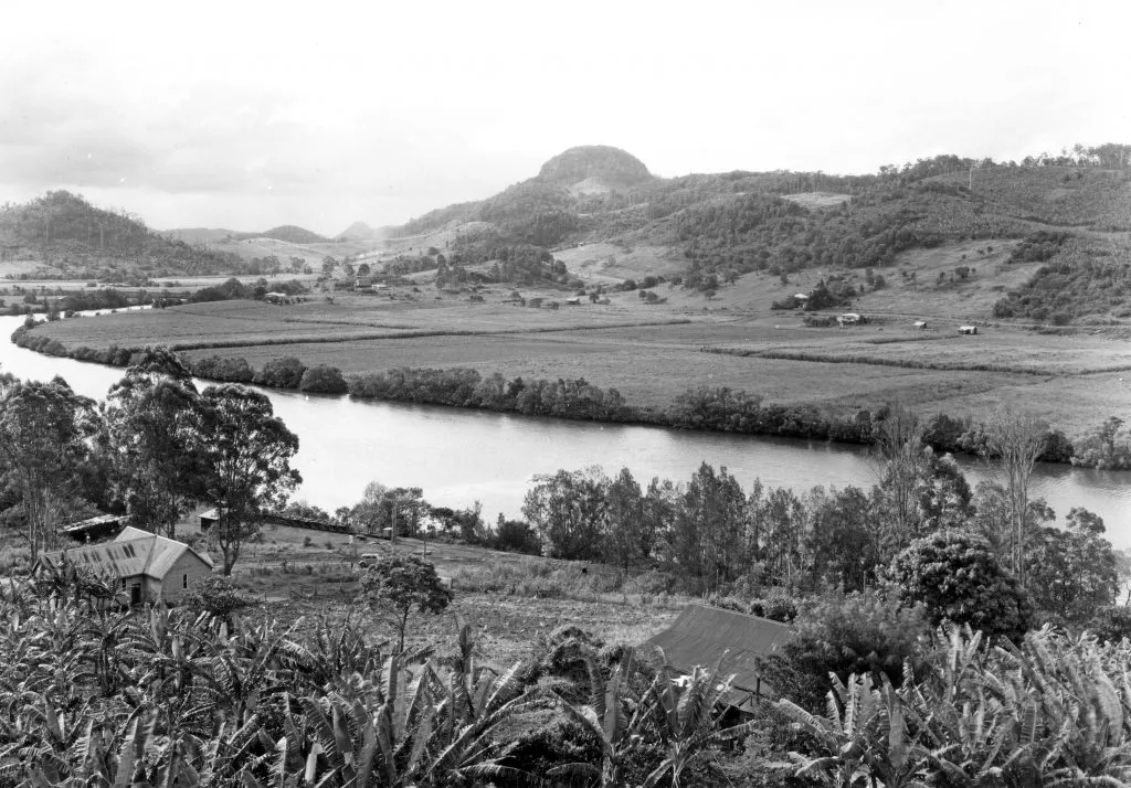
View of the Maroochy River towards Mount Ninderry and surrounding cane fields from Dunethin Rock, ca 1950. Photo supplied by Picture Sunshine Coast.
After the regional sugar mill closed in 2004, land use in the floodplain diversified to a mix of rural uses. Today the Maroochy River is a popular recreational destination for locals and visitors, who enjoy boating, fishing, swimming or just relaxing along its foreshores.
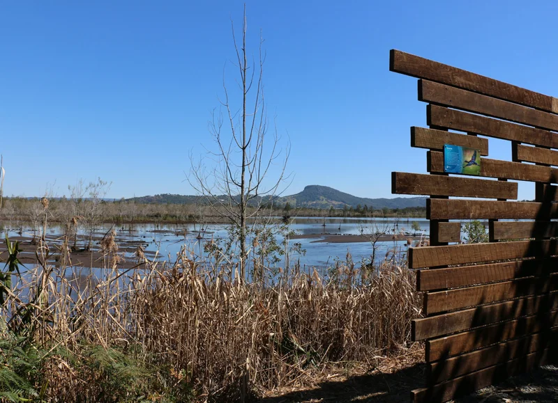
Maroochy River Wetlands, October 2018.
Being a natural floodplain, the area is subject to periodic flooding and acts as a critical flood storage area providing natural protection from the impacts of flooding in the Maroochy River Catchment.
After major rainfall events, floodwaters spill onto the floodplain and form the shape of a heart, to recorded depths in parts of up to four metres.
It is becoming increasingly susceptible to incremental tidal inundation, and under future climate conditions, much of the area is projected to be permanently under water.
WHY BLUE HEART IS SO IMPORTANT TO OUR FUTURE
It may be a catchy name, but Blue Heart Sunshine Coast is a regionally significant place, an innovative project and an Australian first partnership. The project area makes up more than 5,000 hectares on the Maroochy River’s floodplain and at its core lies more than 1,400 hectares of publicly-owned lands. Although the land has been subject to modifications, it still supports diverse and connected habitats.
Acknowledging the Maroochy River floodplain’s significant and ongoing environmental, economic and community value, Sunshine Coast Council, Unitywater and the State Government’s Department of Environment and Science came together in 2019 to launch Blue Heart Sunshine Coast.
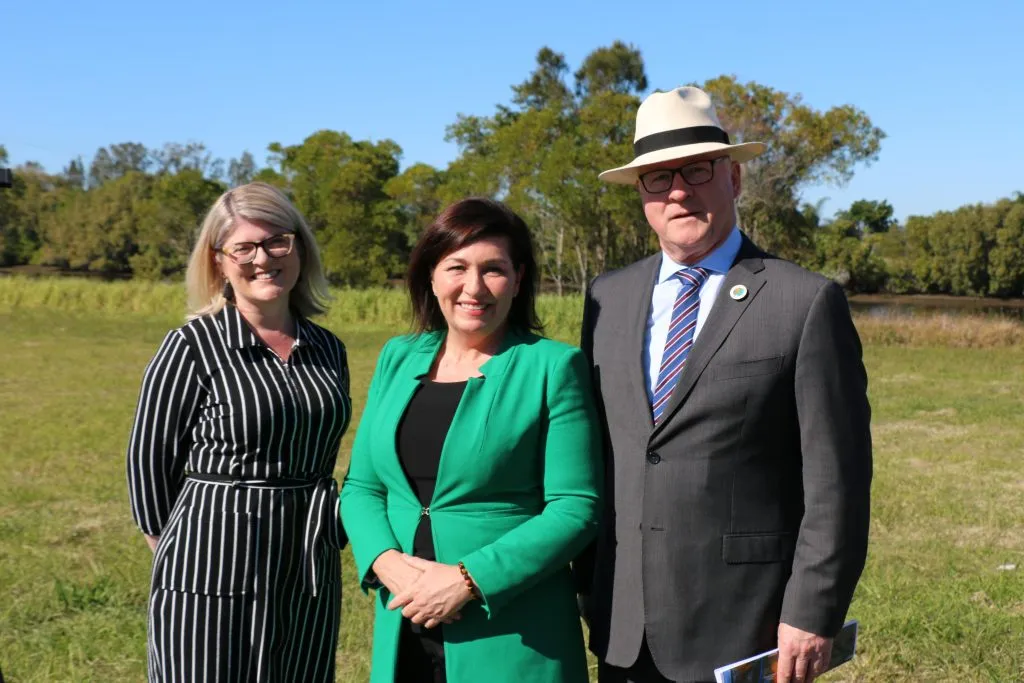
Unitywater Executive Manager - Customer and Community, Katherine Gee, Minister for Environment and the Great Barrier Reef Leeanne Enoch and Sunshine Coast Council Mayor Mark Jamieson at the Blue Heart launch July 2019.
Through this project, the partners wish to work with private landholders and local communities to get the best possible mix of environmental, social and economic benefits from the river and floodplain over the next 80 years and more.
Blue Heart Sunshine Coast will help to protect and conserve our unique floodplain environment. It seeks to identify new and alternative land uses and economic opportunities such as blue carbon opportunities for private landowners. And, it will provide a wide variety of recreation opportunities, like tracks and trails, bird watching and kayaking – to connect people with nature.
In addition, it will respond to the floodplain’s natural transition process, from mostly rural lands to estuarine environments, and proactively planning for the impacts of climate change and sea-level rise on our community.
To achieve all of this, we need to understand the hydrology of the floodplain system — its cycles of wetting and drying — and how that will change over time.
SCIENCE HELPS US PLAN FOR THE FUTURE
The Blue Heart is fed by a number of major streams within a 640 square-kilometre catchment between the Blackall Range and the Coral Sea. Its headwater streams flow from the hills down onto the floodplain, joining into our iconic Maroochy River estuary that stretches 25 kilometres between Yandina and Maroochydore.
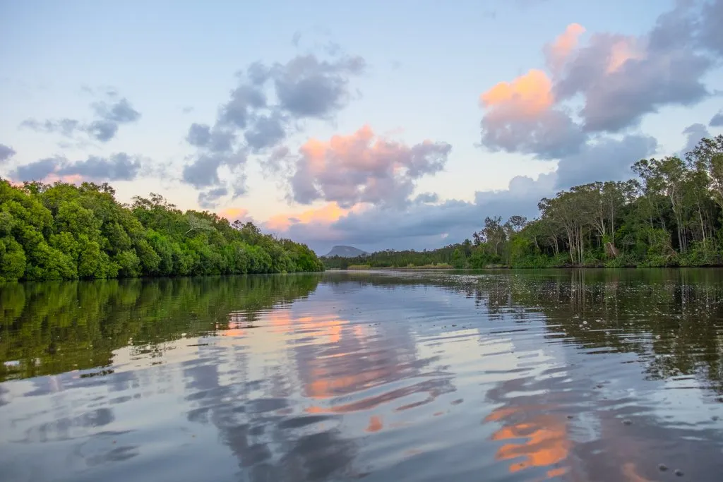
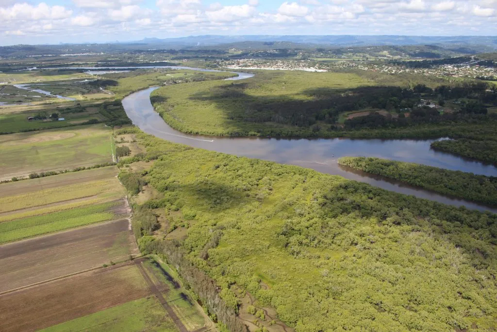
Maroochy River. Photo by A.BOWEN.
When it rains, fresh waters flow down the major streams and their feeder gullies into the river, and eventually out through the mouth into the sea. In dryer times, tidal flows dominate the river. The tides bring salty ocean water up the river and into its connected waterways, then back out again.
Some of the drains and tidal gates installed during the 1900s when sugar cane farming was the dominant land use, have degraded over time and some have been opened in recent years. This has allowed more salty water onto the floodplain with rising tides.
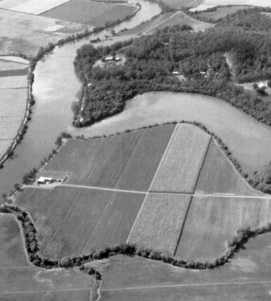
Aerial view of cane properties on the Maroochy River, ca 1930. Photo supplied by Picture Sunshine Coast.
The wetting and drying of some floodplain areas with this salty, tidal water has transformed old cane paddocks to mangroves and salt marsh vegetation areas.
The science tells us that as our climate changes, the land will continue to slowly transition like this as more drains and tidal gates are no longer maintained or become overtopped with sea-level rise – changing and creating new habitat areas.
Over time, with projected sea-level rise, we expect to see increased areas of open tidal waters, mangroves and saltmarsh, and reduced areas suitable for existing farming practices.
That’s why Blue Heart Sunshine Coast is such an important project for our region. It allows us to proactively plan for future environmental, social and economic resilience to support our local community.
In 2020 Blue Heart Sunshine Coast was named the Regional Innovation Project of the Year at the Cities Power Partnership (CPP) Climate Awards. The innovation award seeks to uncover and celebrate transformative climate solutions and inspire other councils and levels of government to proactively manage the impacts of a changing climate.
In addition, the partners have bought more land in the Blue Heart and dedicated it to conservation, rehabilitated waterways, facilitated a Blue Carbon research forum to investigate economic opportunities for private landholders and created community spaces like Unitywater’s Yandina Creek Wetland.
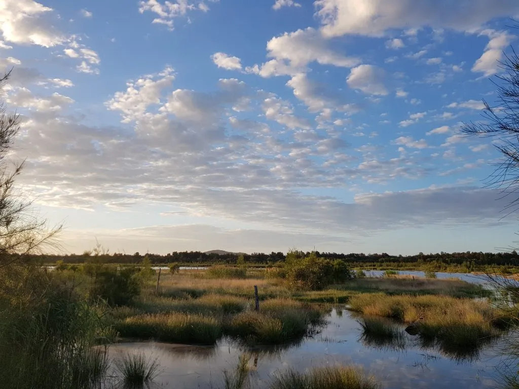
Yandina Creek Wetland. Photo supplied by Unitywater.
Through the Environment and Liveability Strategy, Sunshine Coast Council is committed to supporting waterways and wetlands that are healthy, resilient to change and valued by our community. The Blue Heart partnership is a long-term commitment that will continue to grow and build momentum at a regional, national and international scale.
The Maroochy River and its floodplain have provided abundantly for us for centuries and are central to our local identity and lifestyles. Through Blue Heart Sunshine Coast, we are striving to make the most of the river’s evolving hydrological processes, to benefit current and future generations.
To find out more visit sunshinecoast.qld.gov.au/blueheart.
Last edited on:
First published on: