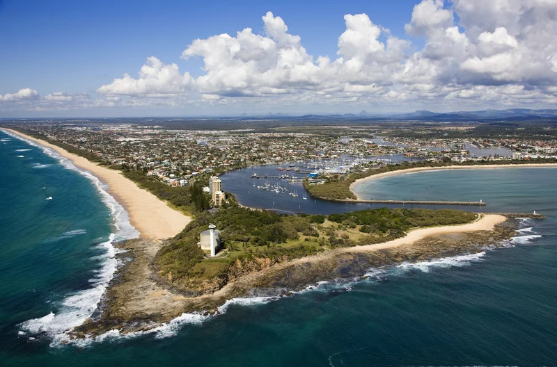
Point Cartwright study provides beacon for future planning

One of the Sunshine Coast’s most picturesque locations is in the spotlight with Sunshine Coast Council embarking on a study to understand how much we love the area and how we use it.
Temporary cameras and counters will be in place over the warmer months to gauge how the area is being used including finding out the number of prams, scooters, dogs, walkers, skateboarders, surfers and more, are visiting.
The study will record aggregated movements and no individual information will be collected.
Information will be stored in accordance with council’s privacy policy which aligns with legislation.
Division 4 Councillor Joe Natoli said the high cliffs in the coastal headland reserve provided spectacular views of Mooloolaba, the Mooloolah River mouth, Mount Coolum to the north and Kawana Beach to the south.
It’s all part of ensuring a safe, shared space and preserving our natural environment.
“It’s no surprise the location is increasing in popularity,” Cr Natoli said.
“Council wants to know how much we love the area and what types of visitors are attracted to the space to ensure we have good, accurate data to feed into future planning activities.”
The study outcomes will help develop a masterplan for the areas encompassing Point Cartwright reserve and adjacent open space areas.
“We want to make sure we have the best available information on the reserve so it can be managed in a safe way that meets our community’s expectations.
“We also want to ensure people understand their responsibilities when visiting the area.”
He said responsible pet ownership had been an ongoing concern raised by the community with many dog owners failing to pick up after their pets or effectively maintain control of their dogs off-lead.
“We know people love to bring their dogs to Point Cartwright and council is committed to raising awareness of pet owner responsibilities so we can be considerate to residents in the local area and visitors to the area.”
Signs at the reserve outline off-leash times and permitted locations.
He said community members would have the opportunity to provide input into the future of the reserve through the master planning process.
“We’re at a very early pre-planning phase where we want to gain a more detailed and factual understanding about how the area is being used.
“That will give us a good basis to work out the best way forward to work with the community to develop the master plan.
“We expect to finalise a master plan next year which will provide a long-term vision for the site and identify how it should function into the future.”
Find out more about responsible pet ownership and where to exercise your dog across the Sunshine Coast, including off-leash, on-leash and prohibited areas at dogs.sunshinecoast.qld.gov.au.
Register on council’s Have Your Say website to stay up to date on all council consultation activities www.haveyoursay.sunshinecoast.qld.gov.au
Point Cartwright Reserve fast facts
- Located near the mouth of the Mooloolah River, Point Cartwright is renowned for its scenic beauty and landmark lighthouse.
- The lighthouse is active.
- The current reinforced concrete pentagonal tower, measuring 32.4 metres in height, was opened in 1979, replacing earlier lighthouses that had been guiding ships into Moreton Bay since 1896.
- Next to the lighthouse is a reservoir featuring a stunning ocean mural.
- The popular walking track starts from either from La Balsa Park on Harbour Parade, or the Reserve carpark at the end of Pacific Boulevard, Buddina.
- The Point Cartwright trail is part of the 96km Sunshine Coast Coastal Pathway.
Last edited on:
First published on: