Council charts right course with new mobility maps
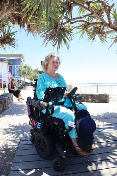
The Sunshine Coast’s new mobility maps are turning heads and wheels after going live on Council’s website.
The revolutionary pilot project is focused on making life easier for people of all abilities from mums and dads with toddlers in tow to the elderly, people using wheelchairs and mobility aids.
Sunshine Coast Council Mayor Mark Jamieson said the project used modern mapping-technology to help improve the way residents and visitors accessed and ultimately enjoyed popular areas of the Sunshine Coast.
“It feels like only yesterday we were announcing the start of the mobility project where wheelchairs were turned into mapping tools with specially trained local “pilots” and advanced technology to track routes from Maroochydore to Mooloolaba,” Mayor Jamieson said.
“I’m pleased to announce the mobility maps are live on council’s website after being generated, checked and compared for consistency before being uploaded online – allowing everyone to find their best path, according to their needs and ability.
“This project came about as a trial to test new techniques to assist community members with limited mobility or people with a short-term injury, to move around the Coast by providing access to maps and wayfinding information about accessible routes.
“The mapping project started with the pilots who have lived experience, combined with innovative technology to collect information about our footpath conditions, access to public transport and parking, amenities, boardwalks, beach mats and more.
“I’m pleased to see Sunshine Coast Council partner with Briometrix, a leading provider of technology solutions for people with disabilities – to undertake this important project.”
The pilots identified the stretch of pathways spanning between Maroochydore and Mooloolaba generally as being of a very high standard.
Categorising clear routes minimises mobility difficulties and allows the user to make informed choices before visiting locations across the Sunshine Coast.
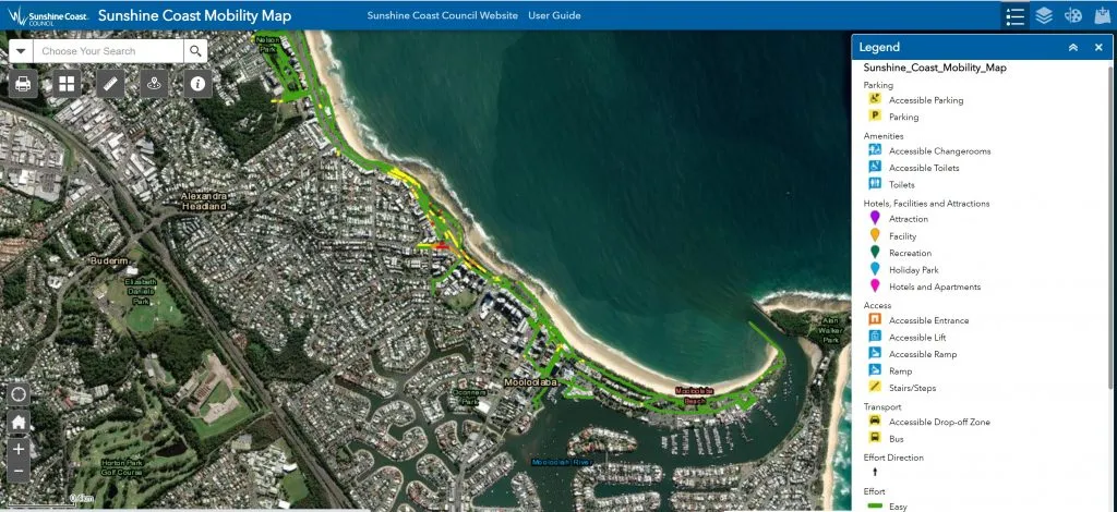
Online mobility maps on council's website
Community Portfolio Councillor David Law said projects like this were important for the region to promote activity, provide mobility options and encourage visitation to our coastal areas.
“Equity and inclusion are key principles we value here at council and in our community, which is why this pilot project was essential in identifying accessible routes suitable for everyone,” Cr Law said.
“One area undergoing significant revitalisation, with an emphasis on accessibility, is the Mooloolaba foreshore, as well as our beach accesses.
“We have some of the most beautiful beaches in the world, and they are becoming increasingly accessible with the availability of beach wheelchairs and beach mats.
“To ensure beach visits are simple and enjoyable for all, we are taking the next steps to map 18 beach accesses within the existing mapping area (Cotton Tree to Mooloolaba) that have a sealed surface and lead to either the beach or a viewing platform.
“The maps will include the north section at Beach Parade, Maroochydore (BA 146) to Mooloolaba Spit carpark in the south (BA 195).
“In coming months, the maps will also include the pathway network around the Sunshine Coast University Hospital health precinct and we are looking to roll out mapping at the Sunshine Coast Stadium sports precinct.
“As the program develops and as budget allows, I look forward to encouraging and delivering mapping for other locations such as our hinterland towns.
“It’s so important that in the lead-up to the Brisbane 2032 Olympic and Paralympic Games, our region provides an opportunity to deliver best practice, fully accessible public amenities that better serve our wider community and prepare the region for the world stage.”
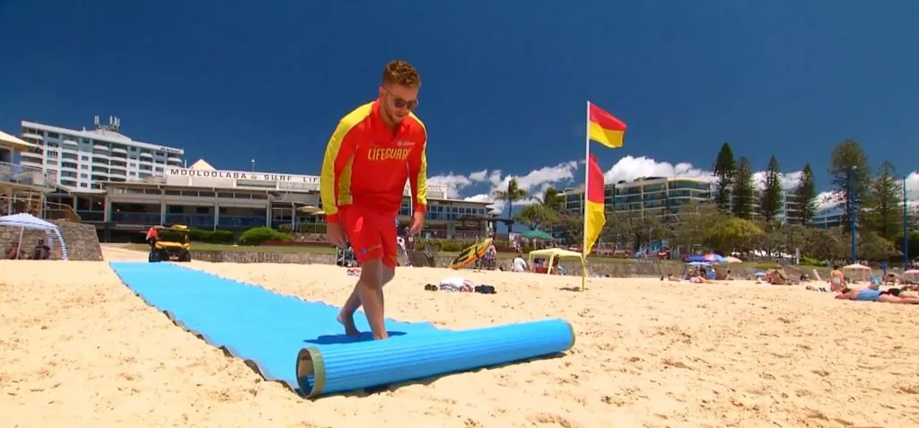
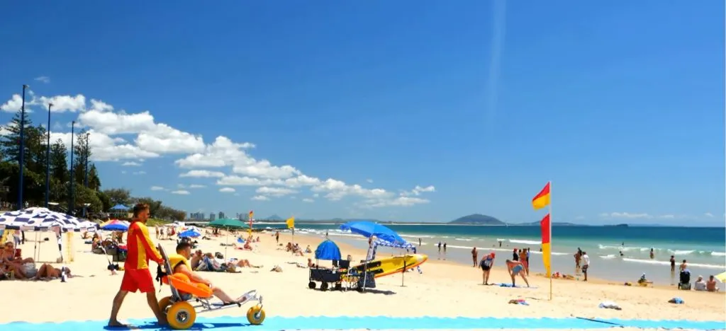
When referring to an ‘effort rating’ it’s based on the grade of the path, the surface condition, and the cross fall of the footpath which helps identify the easiest way and requiring the least effort to get around the coastal strip.
Mobility mapping pilot Dane Cross said these new maps would be life changing for many people living with limited mobility.
“The Sunshine Coast is home to some of the most incredible natural environments in the country, but many locations remain a challenge,” Mr Cross said.
“The areas we mapped from Cotton Tree to Mooloolaba, as well as the Mooloolaba Spit Boardwalk, are a great start.
“These maps are easy to use on your computer or handheld device. I use my phone when I’m out and about to check accessible parking locations, toilet facilities, accessible entries into restaurants and lift locations, as well as the finding the best route between them.
“Hotels and entertainment venues have also been mapped. It just gives me an ease of mind when I’m out and it should help others plan before they leave the house.”
The maps have also identified where there may be limited access due to the steepness of a site or the grade of a pathway.
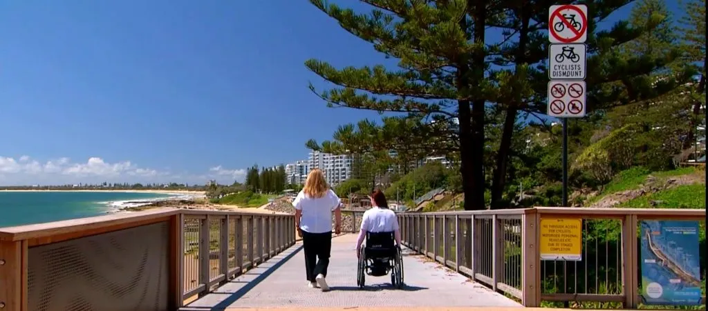
Mooloolaba Foreshore Boardwalk - image courtesy of Weekender.
Council is committed to ensuring facilities are meeting the community’s needs right across the Sunshine Coast.
Sunshine Coast Council will join other local governments and transport authorities across Australia including Brisbane, Townsville, Queensland Department of Transport and Main Roads, Wollongong, Sydney, Melbourne and Public Transport Victoria in deploying Briometrix Mobility Maps.
MORE INFORMATION
To access the mobility maps please visit council’s Mobility mapping website: www.sunshinecoast.qld.gov.au/Living-and-Community/Community-Support/Access-inclusion-and-disability/Mobility-mapping
For more information about the pilot program please visit Briometrix website. For more information about Access, inclusion and disability visit council’s website.
MORE STORIES LIKE THIS
- Wheels in motion for inclusive-mapping pilot project
- Your accessible Sunshine Coast
- Prioritising accessibility at Mooloolaba foreshore welcomed by disability groups